Listen to the article
Designing climate-responsive green infrastructure
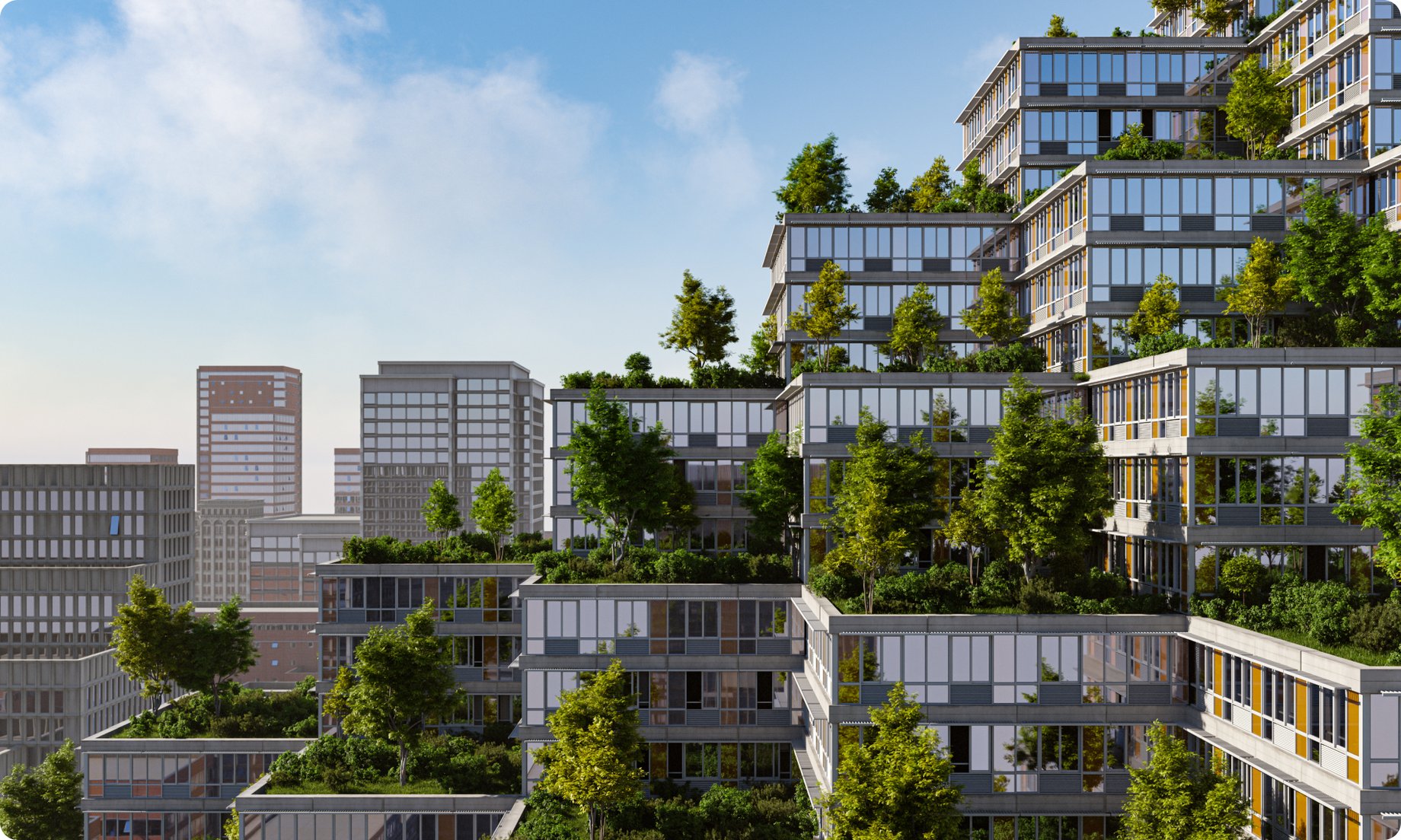
Urban development increasingly requires adaptation to climate change. Higher temperatures, variable weather, and denser construction pose challenges to human comfort and environmental quality. Urban green infrastructure — integrating vegetation within built environments — offers a response that improves air quality, manages stormwater, and reduces heat.
ENVI-met, a high-resolution 3D microclimate simulation tool, enables professionals to assess and optimize the performance of urban vegetation. By simulating the interplay of climate, buildings, and vegetation, ENVI-met helps planners design spaces that support thermal comfort and ecological health.
Understanding complex urban microclimates
Urban greenery is not uniformly effective. Vegetation in cities often grows under stress: compacted soil, inconsistent water, and exposure to heat and pollution. These factors influence plant health and function, affecting services like shade, cooling, and air purification.
Different tree species respond uniquely to localized microclimates. Factors such as solar exposure, soil moisture, wind, and air temperature influence physiological functions including photosynthesis and transpiration. This variability means tree performance can differ significantly within the same urban area — underscoring the need for site-specific design.
How ENVI-met models environmental interactions
ENVI-met is a holistic 3D microclimate simulation tool designed to model the interactions between built structures, vegetation, and atmospheric conditions at high resolution in urban environments. It enables comprehensive calculation of microclimatic parameters such as air temperature, wind flow, and radiation fluxes. One of its core capabilities is simulating vegetation as dynamic components of the urban environment — capturing how variables like sunlight, water availability, and heat affect plant functioning and contribute to localized microclimates.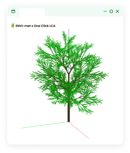
Fig 1. ENVI-met uses a high-detail approach to digitize complex vegetation morphology and physiological functions.
Through these detailed microclimatic simulations, ENVI-met supports planners in evaluating:- The contribution of vegetation to thermal comfort, with precise predictions of cooling effects in pedestrian zones.
- Variations in microclimatic performance based on species selection and morphological traits, enabling tailored landscape design.
- How specific environmental stressors — including heat extremes, drought, and pollution — impact plant health and ecological functionality.
By offering this level of insight, ENVI-met provides an understanding of urban ecological dynamics, supporting professionals as they assess environmental conditions and translate findings into informed design decisions.
Assessing plant health and urban cooling through leaf-level simulation


Fig. 2 ENVI-met enables the simulation of key plant health indicators, including leaf temperature, photosynthetic activity, and transpiration rate.
One of ENVI-met’s distinctive capabilities is its simulation of leaf temperature — a critical parameter for evaluating both plant health and urban cooling potential. Trees regulate ambient temperature through shading and transpiration, the process by which water evaporates from leaf surfaces, cooling the surrounding air.Elevated leaf temperatures can signal reduced transpiration efficiency, potentially impairing physiological performance. ENVI-met calculates leaf temperature by integrating variables such as solar radiation, photosynthetic and transpiration rates, water availability, and localized microclimate conditions. This enables spatially explicit assessments of plant stress and cooling efficacy at a granular level.
A validation study by Simon et al. (2018) demonstrated that ENVI-met accurately reproduced physiological indicators — including leaf temperature and transpiration — when benchmarked against in-situ measurements of Platanus × acerifolia (London Plane) in an urban courtyard. These results affirm the tool’s suitability for high-resolution, physiologically grounded analysis across diverse landscape design scenarios.
Further research supports ENVI-met’s practical applications:
- Feng et al. (2024) used ENVI-met to evaluate how tree species and spatial configurations in residential areas influence thermal comfort, underscoring the importance of species-specific planning and layout.
- Morakinyo et al. (2020) applied the tool to simulate tree selection strategies in urban street canyons, demonstrating how targeted, context-appropriate placement enhances cooling performance and heat resilience.
- Insights from these studies were adapted in the ENVI-met Lagos case study to inform vegetation choices tailored to local microclimatic conditions.
Translating data into resilient urban design with ENVI-met
With ENVI-met, planners and designers can translate complex environmental data into informed decisions that support resilient urban form. The software simulates how vegetation, built structures, and atmospheric conditions interact at high spatial and temporal resolution — allowing professionals to test and compare different design interventions before implementation. Users can evaluate how changes in tree species, planting geometry, surface materials, or building orientation influence key outcomes such as thermal comfort, pollutant dispersion, and hydrological performance. By delivering predictive, site-specific analysis, ENVI-met ensures that green infrastructure strategies are not only visually coherent or regulatory-compliant, but also grounded in real-world ecological function and climatic adaptation potential.
Conclusion
Urban landscape design must increasingly respond to climatic stress. ENVI-met supports this by offering detailed simulations that bridge data and design. For urban planners, architects, and landscape engineers, the tool enhances the precision of green infrastructure interventions — enabling cities to not only adapt to climate impacts but mitigate them.