ENVI-met
Reduce heat stress & improve liveability
ENVI-met from One Click LCA equips architects, urban planners, and developers with advanced microclimate simulation software to design urban environments that stay liveable under extreme heat.
Trusted by professionals — based on science
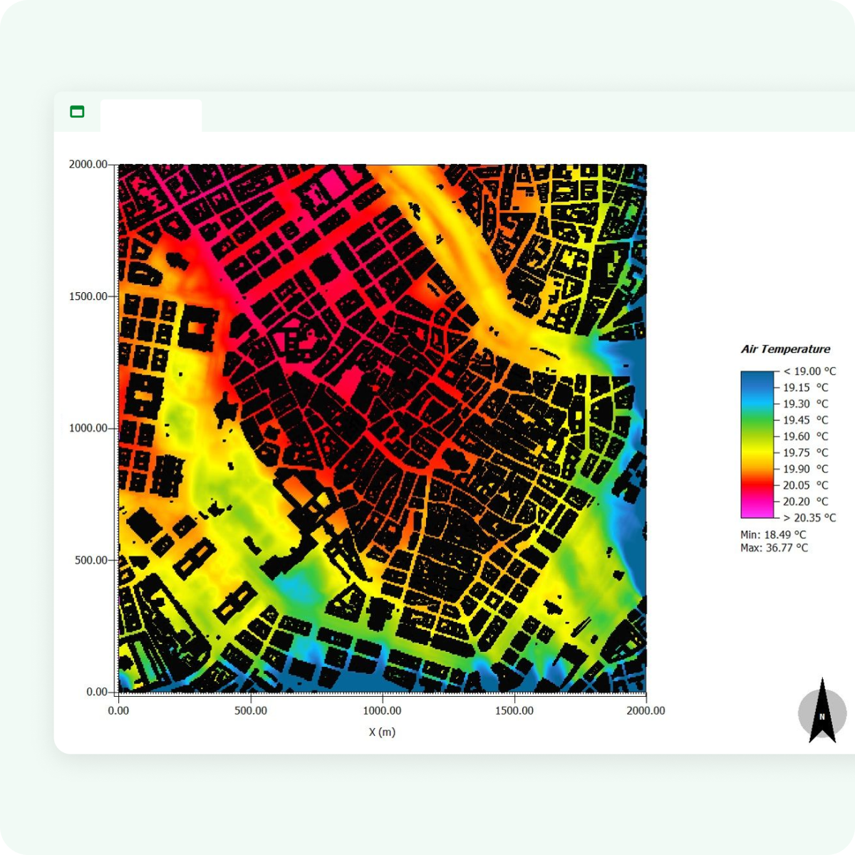
Solar analysis
Simulate short- and long-wave radiation, including shading and reflections, to design spaces that mitigate heat stress.
Wind flow modeling
Use high-resolution 3D simulations to understand wind patterns around buildings and through vegetation.
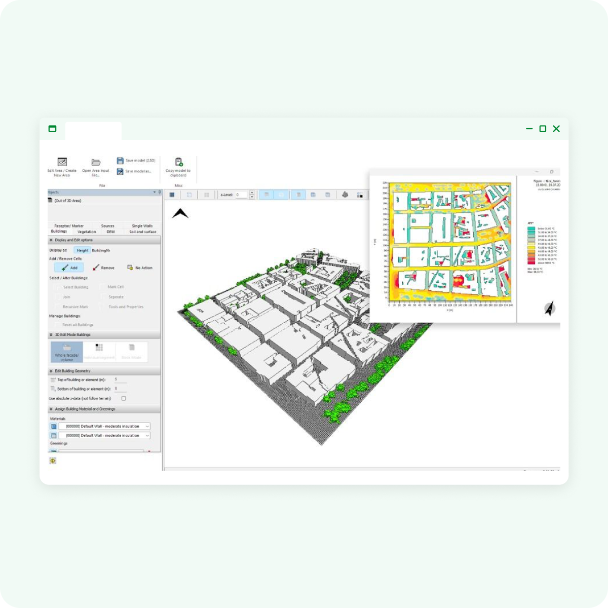
Building physics
Assess surface temperatures of roofs and facades to ensure energy efficiency and thermal comfort in your designs.
Green & blue technologies
Incorporate green roofs, facades, and water bodies to lower urban temperatures and enhance sustainability.
Outdoor thermal comfort
Calculate thermal comfort indices and simulate dynamic thermal comfort for for pedestrians in changing microclimatic conditions.
Vegetation analysis
Simulate plant physiology and water stress to optimize the use of greenery for heat reduction and environmental benefits.
Benefits
Protect human health & reduce urban heat
World's most advanced microclimate simulation software to:
- Improve design with real-time data on wind, heat, and air quality.
- Boost property value by optimizing outdoor spaces for livability.
- Strengthen proposals with data-backed, nature-based solutions.
- Differentiate your services by offering microclimate simulation.
- Maximize ROI with designs that cut energy use and increase value.